New Delhi, March 30 Several states in northern India experienced rainfall, while parts of Jammu and Kashmir and Himachal Pradesh reported snowfall for the second consecutive day on Monday.
Parts of Delhi received light rain on Monday evening, bringing relief after the city had been experiencing a warm day with temperatures hovering around 35 degrees Celsius and humid conditions throughout the afternoon.
Rainfall activity picked up across Delhi between 2:30 pm and 5:30 pm, with Safdarjung recording 0.5 mm, Palam 0.2 mm, Lodi Road 0.7 mm, Ridge 0.2 mm, Ayanagar 0.6 mm, Pusa 0.5 mm, and Janakpuri 0.5 mm, while Mayur Vihar recorded 1.0 mm rainfall, the highest among all stations.
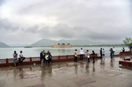
Under the influence of a fresh western disturbance, strong winds swept several parts of Rajasthan, including Jaipur. Many places experienced light rain.
In Uttar Pradesh, Aligarh and Agra experienced light rainfall. The state capital, Lucknow, recorded a maximum temperature of 37.4 degrees Celsius and a minimum of 22.0 degrees Celsius. However, Banda was the hottest place in the state, where the temperature reached 41.4 degrees Celsius, followed by Prayagraj at 40.5 degrees Celsius.
Experts attributed the conditions to a western disturbance and an associated cyclonic circulation over northwest Rajasthan, which led to rainfall over parts of Delhi, Haryana, Rajasthan, and western Uttar Pradesh.
Meanwhile, parts of Jammu and Kashmir experienced snowfall and rainfall for the second day, as the fresh spell of precipitation reduced the rainfall deficit by nearly five per cent.
Light to moderate rains lashed most parts of the Kashmir Valley, while some mountainous areas experienced another spell of snowfall on Monday, according to Met officials. There is also a possibility of widespread rainfall or snowfall in the next 24 hours.
While mild snow continued in the higher reaches of Himachal Pradesh. Keylong received 2 cm of snow, while intermittent rains lashed a few areas in the middle and lower hills. The local met office has predicted a wet spell in the state until April 5, as a fresh western disturbance is likely to affect northwest India from April 2. The Met department has also issued a yellow warning of thunderstorms, lightning, and gusty winds in five districts on Tuesday and ten districts on Friday.
The day temperatures hovered close to normal limits in Haryana and Punjab, a day after parts of the two states experienced rain.
Chandigarh, the common capital of the two states, recorded a maximum temperature of 31.9 degrees Celsius, according to the Met department.
Meanwhile, most parts of Jharkhand are likely to experience light to moderate rain, accompanied by thunderstorms on Tuesday. The IMD has issued an 'orange' alert (be prepared) in five northeastern districts – Bokaro, Dhanbad, Jamtara, Dumka, and Pakur – for hailstorms, while a ' yellow' alert (be updated) has been sounded in the remaining 19 districts for thunderstorms.